
Controllers Online (2)
| BOS_CTR | 1426527 | |
| BOS_1_CTR | 1365310 |
Wind:
Clouds:
Precip:
Alt:
Boston Live Runway Configuration
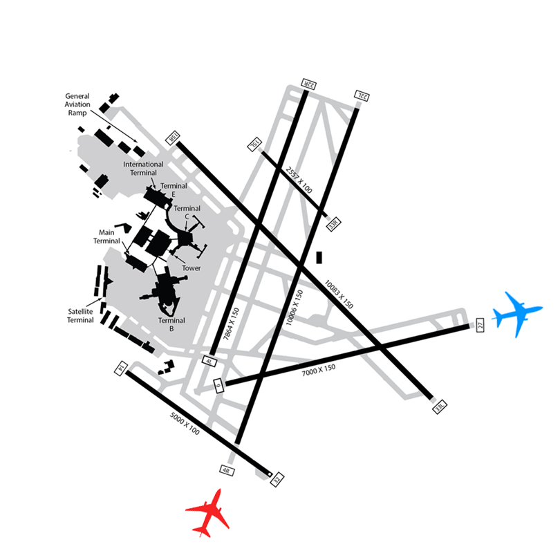
Landing
ILS RWY 4R
Departing
RWY 9
Top BVA Controllers This Month
| 1 | Gustin Robinson | 09h 04m |
| 2 | Mitch Monette | 07h 30m |
| 3 | George Tolis | 06h 53m |
| 4 | Nathan Rankin | 06h 51m |
| 5 | Aidan Mulcahy | 04h 51m |
- Upcoming Events:
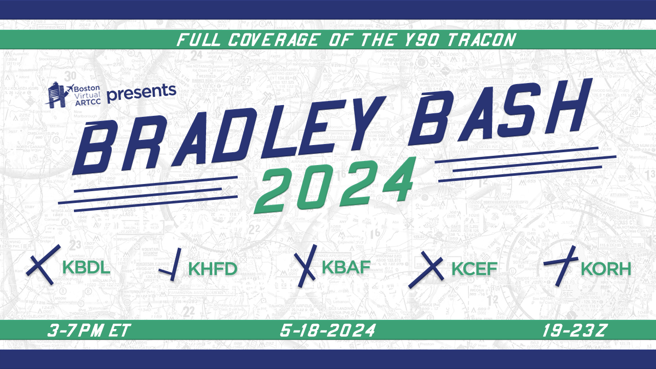
- Bradley Bash 2024
- Escape to the Cape
- Summer on the Seacoast
- The Big Apple Orchard
Welcome to Boston Virtual ARTCC!
Boston Virtual ARTCC (BVA) is a free, immersive, and realistic air traffic control community for pilots and aviation enthusiasts. We provide air traffic control within the Boston ARTCC on VATSIM, covering several popular airports in the New England and Upstate New York regions. In addition, we have an active community of pilots who work with the controllers to create one of the most realistic air traffic control environments available online.
At BVA, you can train as a controller, participate in Wings Over New England, learn from other members in a communal environment, and more! At BVA, everyone is here to learn and happy to help.
If you’re new to the community, learn more about us and submit a free application to join. If you’re a member, sign in above for full access to the community’s resources.
News From BVA
| 2024-05-01 May Logan Informer: Cross the Pond, Boston Tea Party | By: Evan Reiter () |
| 2024-04-01 Boston Virtual ARTCC, Inc. Announces Pricing of Initial Public Offering | By: Evan Reiter () |
| 2024-03-14 VATUSA CTAF Trial | By: Camden Bruno () |
| 2024-03-01 March Logan Informer: New ICAO Flight Plan Form | By: Evan Reiter () |
| 2024-02-01 February Logan Informer: Northeast Corridor Part 2 this Month | By: Evan Reiter () |
Airspace Briefing
Read about scenery, procedures, and other information that all pilots flying in our airspace should be aware of.
About BVA
Learn more about our integrated pilot and air traffic control community or submit a free application to join!
Feedback
We love feedback! Tell us how we’re doing, what you like about flying with us, and how we can improve.
WINGS
Take a virtual tour of New England airports while gaining knowledge on flying within the ATC system.
Preferred Routes
Search for and find air traffic control preferred routes for popular airports in the region.
Charts
Find out more information on where you can get charts and other resources for flying in New England.